Site studies
Site studies completed between 2019 and 2024 confirm that Star of the South is suitably located and feasible to deliver.
- Metocean monitoring
- Marine environment survey program
- Onshore environment and heritage surveys
- Geophysical seabed investigations
- Geotechnical seabed investigations.
Studies were designed and completed by scientists and technical specialists, with local knowledge contributed by those who know the area best – including fishers, Traditional Owners and local communities.
Current activities
We’re not currently undertaking any site studies.
To stay informed, please join our mailing list.
Completed studies
50,000+ marine environment observations collected
200 seabed samples collected and analysed
700 km of seabed mapped
2.5 years of wind data collected
9 local vessels used
Zero safety incidents
Metocean monitoring
We monitored metocean conditions for 2.5 years using 2 floating Light Detection and Ranging (LiDAR) devices.
This study collected site-specific meteorological and ocean data, including wind speed and direction, wave height, air temperature, humidity and atmospheric pressure. Data collected is used to:
- Inform turbine and foundation selection
- Understand expected electricity production
- Plan for construction and maintenance activities.
Marine environment
survey program
We undertook one of the biggest environment and biodiversity research programs of its kind in Bass Strait.
A program of studies designed and delivered by leading scientists and research agencies, including CSIRO and Monash, Deakin and Curtin universities, were completed over 3 years and recorded more than 50,000 observations.
Surveys involved 13,000 hours of field work, collecting information about local conditions out in the field via boat, plane, island trips, tagging and acoustic monitors.
Data collected is used to:
- Inform project planning and design
- Assess potential environmental impacts
- Identify suitable construction methodologies and mitigation measures.
Researchers spent 4,600 hours surveying seabirds and shorebirds to understand species present, their flight heights, behaviours and population sizes.
Study methods
- 26 aerial surveys, with laser measuring technology to record bird flight heights.
- 30 boat surveys
- 12 shore surveys
- Monitoring breeding colonies on nearby islands
- Tagging over 300 seabirds to track their flight paths and heights and collect physiological data
In addition to studying the project area and surrounds, data was also collected from a reference site – Bass Canyon, nearly 100 km away – to gain a regional perspective of seabird species distribution within Bass Strait.
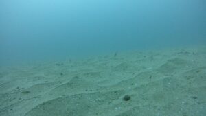
Scientists spent more than 70 days at sea collecting data to understand which species of fish, shark and invertebrates are found in the project area, their abundance and seasonality.
Study methods
- Underwater cameras were used at 130 locations captured over 200 hours of footage
- 2 commercial fishing methods to study typical catches
- 40 echosounders
- Monitoring tagged White Sharks movements
We used Baited Remote Underwater Video (BRUV) to observe the underwater world. This involved lowering a steel frame fitted with bait to attract fish and a camera to record them, over the side of a boat. Each BRUV was left in place for at least one hour to record species diversity, abundance and behaviour. Hear from the team deploying the BRUV’s out at site.
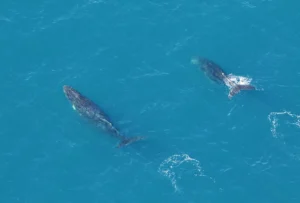
Researchers surveyed whales, seals, dolphins and turtles to understand species present, migration patterns, behaviours and population sizes.
Study methods
- 54 visual aerial surveys
- Underwater sound monitoring in 8 locations to identify whale calls
- Monitoring seal colonies on nearby islands
- Tagging 40 seals to track their movements
Data from up to 100 km away was collected to build a comprehensive picture of whale behaviours, foraging ranges and migration patterns. Around 87% of all sightings were recorded outside the project area.
Aerial surveys are one of the best ways to spot whales like the Pygmy Blue, which can swim under water for up to 90 minutes. Experience marine mammal observers flew as low as 300 m to identify and photograph whales.
This study involved 18 days at sea collecting data on the plants, animals and microbes that live on and in the seafloor, to understand and map biodiversity. Doing this helps us avoid key environmental features, like high-profile reefs, when positioning wind farm infrastructure.
Study methods
- Underwater cameras at 80 locations
- 200 sediment samples collected for analysis
This study involved collecting data on waves, tides and currents to understand natural ocean processes and sediment movement.
Study methods
- 2 nearshore wave and current monitors installed near Snake Island and the Kearney entrance
- 3 floating monitoring buoys in the project area
- Collecting sediment samples
Onshore environment
and heritage surveys
We have studied the local environment, ground conditions and cultural heritage values along the onshore transmission route, between Reeves Beach and Giffard.
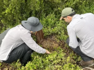
Ecologists and zoologists completed detailed surveys to determine the amount, type and quality of native vegetation, and establish if and how the area may be used by native animals.
Data was collected using a range of methods, including remote sensing cameras, hair tubes, searching for droppings, playing recorded animal calls and listening for responses, and visual searches.
Findings are used to avoid significant areas where possible.
Archaeologists and Gunaikurnai Land and Waters Aboriginal Corporation (GLaWAC) representatives surveyed the area for evidence of Aboriginal cultural heritage, such as scattered artefacts, burial sites, scarred trees and shell middens.
Findings are used to avoid significant areas where possible.
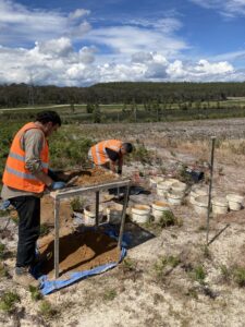
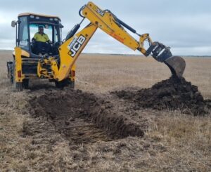
Geotechnical engineers collected soil and ground samples at various locations along the transmission route for testing.
Findings are used to design of the underground cable system.
Specialists collected data on existing noise levels in local communities to model potential noise impacts from construction activities on land and out at sea.
Seabed investigations - geophysical survey
A specialist vessel with soundwave equipment and crew spent 4 weeks at sea in 2020 to measure water depths, map the seafloor and identify any buried infrastructure such as cables.
Seabed investigations - geotechnical survey
A specialist vessel and crew of 50 spent 5 weeks at sea collecting soil and rock samples from up to 70 m beneath the seafloor. Data collected is used in turbine foundation design and placement.

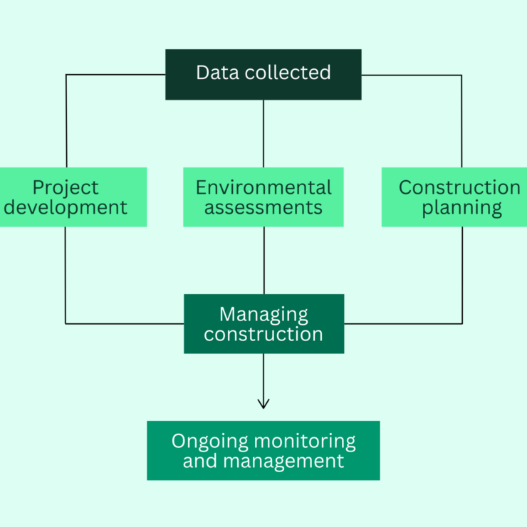
HOW WE USE STUDY FINDINGS
Findings from our site studies, combined with other available data sources, provide a comprehensive understanding of existing conditions in the Star of the South project area.
We use study findings to:
- Design a project that is safe and suitable for the local conditions
- Prepare environmental impact assessments, which help inform government approval decisions
- Protect marine life and the environment by avoiding and minimising potential impacts
- Plan efficient and sustainable construction and operations
- Provide a baseline for ongoing environmental monitoring to track any changes over time.